Archive
January
February
March
April
May
June
July
August
September
October
November
December
|
|
|
|
|
January
February
March
April
May
June
July
August
September
October
November
December
|
January
February
March
April
May
June
July
August
September
October
November
December
|
|
January
(1)
February (1)
March
April
May
June
July
August
September
October
November
December
|
January
February
March
April
May
June
July
August
September
October
November
December
|
January
February
March
April
May
June
July
August
September
October
November
December
|
January
February
March
April
May
June
July
August
September
October
November
December
|
|
|
January
February
March
April
May
June
July
August
September
October
November
December
|
January
February
March
April
May
June
July
August
September
October
November
December
|
|
 Frame of Mind Frame of Mind
I appreciate shares as it helps grow my business. Enjoy!
_________________________
Featured Posts
2023 In Review
 2023 In Review 2023 In Review
2018 Coast to Coast RV Roadtrip
 2018 Coast to Coast RV Roadtrip 2018 Coast to Coast RV Roadtrip
_________________________
Recent Posts
This past weekend, my husband planned a few fun excursions for us to do locally.
Saturday was Carson Springs Wildlife Sanctuary (CSWCF), "a conservation and educational facility that rescues exotic animals in need. Sitting on 275 acres of lush Florida woods and farm land, it is home to approximately 30 rare and endangered species and over 100 animals. CSWCF is a 5013c nonprofit registered in the State of Fl ( #CH36249), licensed by USDA, Florida Fish and Wildlife Commission, Alachua County and ZAA accredited facility. It has never had a citing or violation."
It was their annual open house and we spent a few hours roaming around viewing the animals and learning a little about them, observing feedings and interactions. At one point, a volunteer even had one of the big cats up at the fence purring for us, and it was a loud and lovely sound!
Click on the photos to see more in the gallery.

The following day we headed up north to Ichetucknee Springs Blue Hole for some SCUBA Diving in the cavern of one of the headsprings. This is one of our favorite spots because it typically is not as crowded due to its more remote location; however, this day it held more visitors than normal. No matter though because where we hang out, few dare to venture. Its a crystal clear spring with a dreamy blue color, and a small crevice opening into a cavern system below where the springs strongly force their water through, contributing to the 233 million gallons of spring water Ichetucknee feeds into the Santa Fe River. Once we make it through that crevice past the force of the surge and drop 45 feet to the bottom, we are able to peacefully explore more of the beauty and depths of the cavern system, all while keeping a careful and watchful eye on the opening above as it grows smaller and smaller. It is completely otherworldly down there! The way the water has worn away the limestone and tiny pockets of air being held, the darkness in the gradual light as we float along...it actually feels like we are on another planet. Nothing can match it.
Click on the photos to view more in the gallery.
(GoPro imagery shot by my wonderful husband, video shot by me and let me say, I am NOT an underwater photographer!)
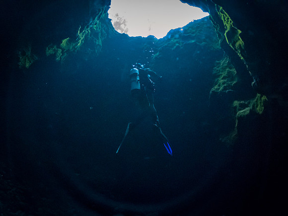 Ichetucknee SpringsIn the Cavern of Ichetucknee Springs Blue Hole
Ichetucknee SpringsThe crystal clear blue springs of Ichetucknee (Let it be known, I am no underwater photographer!!) Ichetucknee SpringsIn the Cavern of Ichetucknee Springs Blue Hole
Ichetucknee SpringsThe crystal clear blue springs of Ichetucknee (Let it be known, I am no underwater photographer!!)
To end the day, we headed a little farther north to Live Oak to a spot Justin learned about, the Suwannee Springs Graffiti Bridge and Suwannee Springs Park. The bridge is a gem of a discovery I will have to revisit to photograph more as this was a quick stop at the end of our day, but a wonderful surprise it was! (Note to self, next time, bring spray paint). It was a hell of a windy day too which made me very apprehensive with flying the drone within the structure. I was able to get three good enough images for posterity sake though. I'll expound more on this work of art after a later visit and more photography. Who knows what might inspire me further there. Just down the riverbend are the remnants of Suwannee Springs, a sulpher spring where during the late 1800s, early Floridians would visit the Spring House (remnants in photo) to bath in the healing waters.
Click on the photo to view more in the gallery.
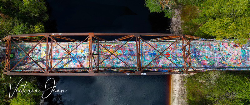 Suwannee Springs Graffiti BridgeAn aerial view of the Suwannee Springs Graffiti Bridge spanning the Suwannee River in Live Oak, FL. Suwannee Springs Graffiti BridgeAn aerial view of the Suwannee Springs Graffiti Bridge spanning the Suwannee River in Live Oak, FL.
While waiting to have an opportunity to travel and shoot another launch, I revisited one of my recent favorite experiences, the visit to the Indian River Lagoon in Florida where I got to see bioluminescence for the first time in my life!
I wanted to composite the few photographs I made into one single image to represent that night, so here it is! Kayaking on the water, disturbing the bioluminescence to flush out a glow of blue under the force of the whirling water.
While I was working on it, I noticed a tiny detail I hadn't seen before... I actually caught the Starlink Train low on the left horizon in the photo, double win! It's funny to me because I had been joking of how it would be a great shot if I could also capture the Milky Way, a rocket launch and lightning all at the same time. Don't laugh, it could happen!
The bioluminescence of the Indian River Lagoon in Florida releases a glowing blue light in the dark of night when disturbed. This twinkling light is caused by dinoflagellates, microscopic single-celled organisms that releases light as a defense when it receives pressure on its cell walls. This lagoon is so full of these organisms, you can't avoid making a disturbance. Even the fish swimming through the warm water create an eerie glow. It's truly a magical experience.
Enjoy the photo, or better yet, make a trip to experience this magical phenomenon yourself! You won't regret it.
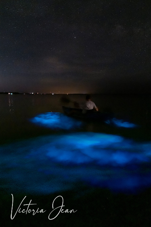 Bioluminescence CompositeThe bioluminescence of the Indian River Lagoon in Florida releases a glowing blue light in the dark of night when disturbed. This twinkling light is caused by dinoflagellates, microscopic single-celled organisms that releases light as a defense when it receives pressure on its cell walls. This lagoon is so full of these organisms, you can't avoid making a disturbance. Even the fish swimming through the warm water create an eerie glow. It's truly a magical experience. Bioluminescence CompositeThe bioluminescence of the Indian River Lagoon in Florida releases a glowing blue light in the dark of night when disturbed. This twinkling light is caused by dinoflagellates, microscopic single-celled organisms that releases light as a defense when it receives pressure on its cell walls. This lagoon is so full of these organisms, you can't avoid making a disturbance. Even the fish swimming through the warm water create an eerie glow. It's truly a magical experience.
I was preparing to go out to attempt to photograph the International Space Station passing overhead when I got the weather alert on my phone of an approaching storm. I looked outside and sure enough, the sky was quickly clouding over, spoiling any chance at seeing the space station transit Florida. I was disappointed, but the growing grumble of thunder in the distance abated my disappointment. Anyone that knows me, knows how much I love thunderstorms... and this one was proving to be ripe with lightning! So, I made lemonade out of lemons.
Instead, I took my gear out to the dock to try to catch some lightning. Typically, Easterly moving storms don't prove to be worth shooting as all the lightning is on the approaching end, not a good vantage point for me on the dock, which has a great westward view. However, this particular storm had a few pop-up cells trailing behind it. I waited until the rain passed and headed out. I watched the sky dance with the glow of all the rain-wrapped strikes, not seeing any distinctive bolts for almost a half hour, then the trailing pop-ups came through for me, fast but furious. They blew threw within a matter of seven minutes. I must have lost a good twenty strikes between changing lenses, but this is what I caught.
I'll catch ISS next time, for now, I'm happy with the lightning.
 Lightning on Santa FeA sliver of the sky as a storm passed through on September 12 over Santa Fe Lake, FL. The sky was crawling with lightning. Lightning on Santa FeA sliver of the sky as a storm passed through on September 12 over Santa Fe Lake, FL. The sky was crawling with lightning.
Shot facing north east as storm traveled east.
 Lightning on Santa FeA sliver of the sky as a storm passed through on September 12 over Santa Fe Lake, FL. The sky was crawling with lightning. Lightning on Santa FeA sliver of the sky as a storm passed through on September 12 over Santa Fe Lake, FL. The sky was crawling with lightning.
Shot facing north east as storm traveled east.
ULA Atlas V NROL-107 (Silentbarker)
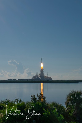
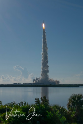
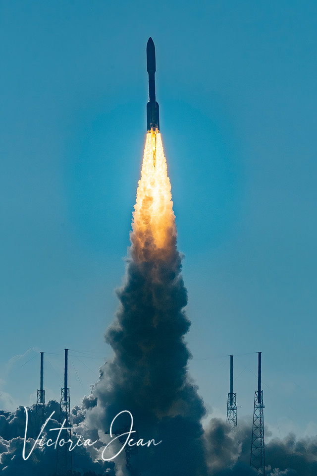
Atlas V successfully launches from AMSPACE LC-41 at Cape Canaveral Space Force Base, Florida at 8:47 am Sunday, September 10 after two delays (one from inclement weather threads due to hurricane Idalia).
MISSION DETAILS:
-
Type: Government/Top Secret
-
Launch Cost: $153,000,000
-
Classified space situational awareness (SSA) payload for the US National Reconnaissance Office (NRO).
-
LAUNCH PROVIDER: United Launch Alliance (ULA)
-
ROCKET TYPE: Atlas V 551
- LAUNCH PAD: Space Launch Complex 41
A United Launch Alliance (ULA) Atlas V rocket launches the SILENTBARKER/NROL-107 mission, a joint National Reconnaissance Office (NRO) and U.S. Space Force (USSF) capability to improve space domain awareness.
In plain terms, it will form a watchdog type of satellite formation to search for and monitor threats from other countries, able to track objects as small as a basketball, watching their position and movement. The payload this rocket carried was heavy enough to demand ULA's most powerful engine configuration, the Atlas V 551. It was a sight to behold from the Gantry, a mere 2.3 miles from the launch pad site.
 Atlas SilentBarker Atlas SilentBarker
 Atlas SilentBarker Atlas SilentBarker
 Atlas SilentBarker Atlas SilentBarker
SilentBarker Video of Launch
SpaceX Falcon 9 Rocket Blazes Into Orbit Carrying Starlink Group 6-14
Mission Details
- Type: Communications
- Launch Cost: $52,000,000
- Location: LC-40 CCSFS
- Orbit: Low Earth Orbit
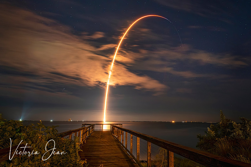
After a few hour delay, a batch of 22 satellites for the Starlink mega-constellation – SpaceX’s project for space-based Internet communication system, successfully launches at 11:12 pm on Friday, September 8, 2023 from LC-40 at Cape Canaveral Space Force Station. The Block 5 variant is the fifth major "production run" aimed at improving the ability for rapid reuse of the rocket, better reliability and performance. Following the stage separation, the first stage (reusable part) will return to land on a droneship on the Atlantic Ocean, so there will be no booster return burn to see in this photo, but the sonic boom was still heard and felt upon booster return!
The Starlink satellites are actually a fun spectacle to watch for in the night sky. They are called the Starlink Train. Take some time to look up and see if you can spot the train moving through. Use this interactive locater to see when they will be visible in your area. It uses your actual location, even giving you a VR type of viewer to help you know where to look and visualize what they may look like in the sky in your exact area. Play with it a bit on your desktop monitor then give it a try on your cell phone. I hope you have as much fun with it as I do!
https://james.darpinian.com/satellites/?special=starlink&fbclid=IwAR2pXCIbILo_xGYjJLKBc-9nMqkpo9PwRj7p4VhubN1PI7GTdGfQEjOSZSo
 Falcon 9 Starlink 6-14SpaceX Falcon 9 Rocket Blazes Into Orbit Carrying Starlink Group 6-14 Satellites Falcon 9 Starlink 6-14SpaceX Falcon 9 Rocket Blazes Into Orbit Carrying Starlink Group 6-14 Satellites
Labor Day weekend always brings another special holiday for me, my Mom's birthday. This year was a special milestone that I wanted to make sure to share in person with her, so off to New York I go for a quick weekend. She stays in Saratoga Springs for the summer, with my sister. My sister's place is a beautiful historical home that sits on the edge of the Graphite Range Community Forest, over 200 acres of forest for recreation like hiking, biking, skiing and more. We have enjoyed many hikes up in these woods, and have enjoyed the remnants of the old graphite mines that can still be seen today. It is such a gorgeous area to enjoy, I can say this photo really does not do it justice. If you want to learn more about this treasure, visit Saratoga PLAN.
About the photo: Shot with DJI Mini Pro drone, approximately 15 images, carefully stitched together for 3 different panoramic levels, then once again for a solid frame and hand blended to get proper exposure throughout. A painstaiking process that was worth the extra effort to maintain the detail in the shadows of the trees while holding the glowing vibrance of the setting sun.
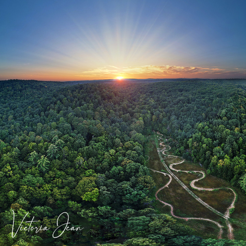 Graphite Range Community Forest ©Hiking and biking trails at Graphite Range Community Forest at the foothills of the Adirondacks in Saratoga County, New York. It has 200+ acres for recreation for hiking, biking and skiing. Get out and enjoy it! Graphite Range Community Forest ©Hiking and biking trails at Graphite Range Community Forest at the foothills of the Adirondacks in Saratoga County, New York. It has 200+ acres for recreation for hiking, biking and skiing. Get out and enjoy it!
From the moment I first saw a photo of a rocket launch, the sweeping graceful arc glowing in the sky, I knew it was something I wanted capture and perhaps even see in person. Now that I'm living in Florida, I have more of an opportunity. Then came Artemis. The mission that was going to take man back to the moon. The big rocket. History in the making.
I live approximately 150 miles from Kennedy Space Center where rocket launches are occurring on a regular basis. I could make the 3 hour drive to go down and see one after work or on the weekend any time I wanted to, but did I mention, 3 hour drive?!
So I resigned to watching Artemis from the dock on Santa Fe Lake where we live. Bonus, it was a night launch, so this was my chance to try my hand at creating my coveted arc shot, a long exposure single shot of the launch from start to finish. Single exposure, meant only one chance to get it right, and with Artemis being such an historic launch, I had better not muck this up.
I spent several weeks leading up to the launch reading up on how to shoot a nigh launch, how to follow trajectory, getting good resources to follow. Little did I know I was just dipping my toes into what was going to be a glorious ocean of vast experiences and loads of fun (and a lot of work).
The night arrived when Artemis was scheduled to go up. My husband and I waited impatiently on the dock to see if we would be able to make it out from so far away, we had no idea what to expect. I had my camera on a tripod all set up with what I hoped were the correct settings, ready for one long shutter speed single shot. I was so excited, I couldn't wait. More people started to wander onto the dock for viewing. I was getting more excited. We started the live feed on our phones to listen to the play by play, how thrilling. The sounds of the shuttle as it worked to ready itself for the historic launch. T-60 seconds. I started shaking I was so excited. T-30 seconds... THE WHOLE DAMN SKY IN THE SOUTHEAST BEGAN TO GLOW... Thats when we learned there was a delay in the live feed to real time.
It was happening! I fumbled to hit my shutter release cable. Did I catch it in time? The glowing sky grew as if a bomb had gone off (or as I imagined that to look) with a slow red golden glow expanding across the entire horizon, breaking the black of night. As it slowly faded back, we saw it, the rocket rising above the tree line in a slow climb, steady and confidently toward space. I saw the graceful arc into orbit and prayed I had it all on camera.
I was totally dumbfounded, my mouth hanging open at how magnificently bright and beautiful it looked from so far away. It was from that moment I knew I was hooked.
It took all of 4 minutes. It seemed to last forever. Did I catch it? I couldn't wait to check, but I dare not stop the camera too soon and miss any part of that graceful arc. As soon as I couldn't see the shuttle any longer, I stopped the exposure and quickly hit the playback button to reveal the one single photo, the only chance I had for this historic launch.... moment of truth, I would be crushed if I didn't get it.
And as if I heard angels singing, when the image came up on the screen, there was that beautiful glowing arc, I HAD DONE IT! My first attempt at the rocket arc, and on such a meaningful launch, I had done it!
Thing is, it isn't as easy as I though it should be, it actually IS rocket science (pun intended). I've tried several since, I totally missed one (heartbreaker), messed a few others up, but with each one, I learn something new. This is certainly a skill I am working on growing, and I'm loving it. It takes dedication, long drives, staying up until wee early hours of the morning, carefully learning and researching manual exposures on my camera, learning all about rockets (the coolest part) and learning my way around a town I'm not at all familiar with which is also strictly controlled by NASA security during launch events. And its all worth it.
Artemis Launch, my first ever rocket launch photograph.
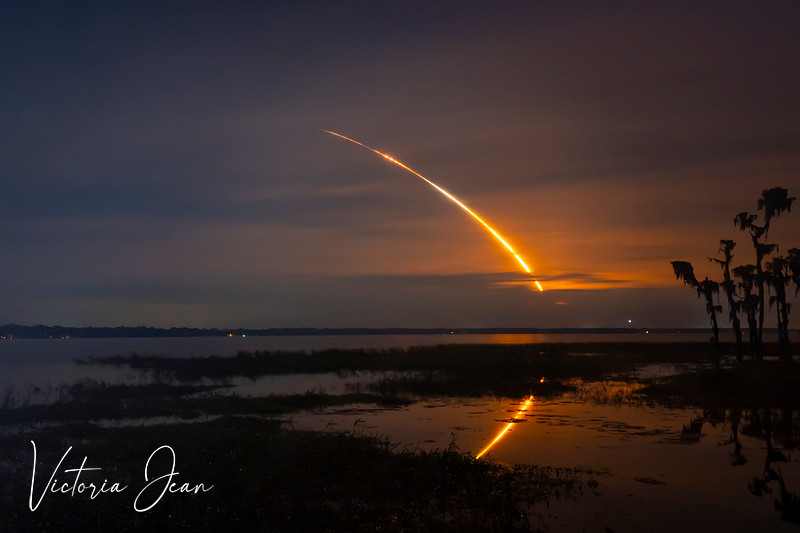 Artemis 1 Artemis 1
Its hard to believe this epic 3-month RV trip across the country was a year ago (began 2018)!
Looking back at all the pictures and reading the posts makes me feel like I'm living it all over again!
If you missed it the first time, you can relive it all by clicking HERE! You can relive every moment with us, siply click on "next post" at the bottom right of each entry.
 2018 RV Trip 2018 RV Trip
The 2018 RV Trip Comes To An End
Click Here to Get to Entire RV Trip Gallery
Tuesday, April 10
Leaving the Suwannee Park area today, sadly because I love this place. We need to make it to Boca by the 12th and have one more cool place to stop along the way. We drove east for several hours and made it to the Silver Springs area just outside of Ocala. This was as far as we'd go today. Time to rest up and do some laundry. We found a nice RV resort to pull into just before the rain started again.
Wednesday, April 11
Up early today with a short drive to get to Blue Springs State Park. Justin found this as a good spot to dive; a clear spring that forces out over 100 million gallons of water daily. It was a clear and sunny day around 68 degrees. The park was quite large. We checked in with the ranger, who gave us a brief outline of what we were not allowed to do while diving. First being not to mess with the two remaining manatees, second being not to enter the cavern system deep within the springs we were diving. I perked up at the mention of manatees, not expecting to see any, how lucky was I? This springs system is one of many they congregate to in masses during cooler winter months. The water stays a consistent 73 degrees for them. Right about now, they all should be moving back out, but two remained behind.
We found a great spot to park thick with shade. Lil would rest comfortably while we spent some time diving. We donned our gear and walked the boardwalk to the divers entrance. It felt like a jungle, with a lush green canopy of trees and plants around us. The water was crystal clear, absolutely beautiful! Right away we were able to spot the manatees, marked by park service with buoys on their tails. As we dropped into the shallow waters, I was surprised to feel the force of the current working against me. We sure wouldn't be swimming to the crevice, for this current was very strong. We could stand, with water at our chest, so we slowly waded through the water into the mouth of the spring. In my grace, I stumbled a time or two over fallen logs, clear as day to see, but I was watching the manatee buoys instead of where I was walking!
Once we were as far back in the springs as we could go, we put on our masks and dropped below the surface. Damn! Beautiful does not do it justice. The way the sun was splitting across ripples on the surface, it made diamond shaped illuminations that danced across the sandy bottom. It was so clear, I could see the lumbering giant sea cows 30 feet from me. Since they are protected, and it is illegal to bother them, I just stared for a while as they gently poked around the bottom picking at plants to eat.
We swam up on the crevice we were to dive. At first, the pitch black gap felt too ominous and uninviting to me. I felt just fine hanging out here in shallow water watching manatees play. Justin was first to descend, down between fallen trees into the crevice. It wasn't very wide, but opened up more as we dropped. I followed, and my eyes eventually adjusted so it wasn't a black hole any longer. Rather, it became a surreal underwater mini canyon. The force of the springs had worn away stunning formations in the limestone. I wanted to see more, so we kept diving farther down, pushing against the force of the surging water, until we eventually reached the depth of 60-something feet where the cavern system began. No farther could we go, which was fine with me, it was pretty dark this far down. I rolled over and looked up to see the remarkable image of sun rays streaming into the opening far above. Once again, I paused to appreciate it for a minute. Eventually, more divers entered the crevice, making it a little too crowded for my liking, so we eventually made our way back up into shallow water. It was at that point that I turned my GoPro to video to record bits of the swim through the shallows, letting the current carry us. There were so many fish, huge pan fish and even some long gars near the end. You'll have to watch the video to see what I saw.
Click on the photo above to see pictures from the dive.
Click on the video below to see the drift through the current in shallow water.
After the excitement of the dive, we returned to the RV to clean up and start heading for Boca, where we would spend the next few days with family.
Friday, April 13
Friday the 13! I didn't even realize that until the day was almost over. It was a quick visit with family, but we had reservations with a dive charter in Venice for tomorrow, so we had to get moving. Venice is said to be the fossil shark tooth capital, with divers able to find many teeth along its waters. I was itching to see what the buzz was all about. We left late in the day after dinner, and arrived 4 hours later in the Venice area, around 9:30 pm, both fully exhausted from an eventful couple days. The spot we reserved would have been the perfect size for us, had the thickskulled self-important moron in a huge motorcoach in front of us not attached his trailer with car- it sat at least 25 feet over in our space and we had to work around it to get the RV hooked up. I was just glad we had a spot and could fit in, I was too tired to stress over it. As the story seems to go, another early morning in store for us, so we needed to get some sleep.
Saturday, April 14
I dreamed of shark teeth last night, excited about the charter dive with Florida West we had scheduled this morning. The RV park we chose was close to the dive shop, and had electric so we could leave Lil in the AC to relax (she spent the last two days with a house full of doggies to play with). We rolled the scooter off and stuffed our few pieces of dive gear on, then burned off to the dive shop. There we were outfitted with the remainder of dive equipment we'd need for diving off the coast in the gulf waters. The last time we tried this, the charter was cancelled due to high winds, but today looked perfect with the only signs of bad weather rolling in later tonight.
We boarded the dive boat with several other eager divers, and they carried us out into the gulf. A warm morning, salty breezes on our face, turquoise blue water, it felt like paradise. The dive master dropped in the water, checking for good spots for us, and when he was satisfied, he gave us the thumbs up to plop on in. Justin and I dropped to the bottom at a depth of around 30 feet, ready to start hunting for teeth. The visibility wasn't perfect, seeing only around 10 feet in front of us, but it was far better than that of the Cooper River. I poked around with my hands, trying not to stir up too much silt. I knew I was on the search for fossil teeth, but the marine life down there simply captivated me, distracting me over and over again from the task at hand. We found a seahorse, many live seashells, and attracted a school of fish along the way. The teeth however, not as plentiful as advertised. Justin and I each found a partial megalodon tooth, and a handful of smaller teeth. We completed a total of two dives in the 77 degree water, and I was exhausted and chilly by the end of the second. The weather was changing, bringing in wind and higher swells on the surface. While we could surface swim to the boat after the first dive, the captain had us stay put on the second, bringing the boat to us instead. Exiting the water with all our gear and weights was more challenging with the boat rocking and bucking in the wind. All in all, it was a great experience and we didn't leave empty handed. Let me just say, there really isn't much that is sexy about diving; the wetsuit is tightly adhered to every roll in your body, hair becomes an entangled mess of algae and debris, the mask leaves a long-lasting indentation around your face, the regulator in your mouth bulges your lips out like a swollen fish, and let's not forget the snot or saliva strings drizzling from your face just after emerging from a dive... but I wouldn't trade it in for anything.
This photo is my view as I surfaced from my first dive.
This is a photo of our collective finds.
Play the 10 minute video below to see our dive highlights.
While the water looks green, it really is much clearer.
The GoPro rendered to the best of its (and my) ability.
After the dive, we scooted back to the RV, showered and cleaned up and pulled out to find lunch. We were both starving, and butter burgers and frozen custard from Culvers sounded perfect! After lunch we drove another 3.5 hours north back to the Live Oak area to look again at some land we were interested in. It was a hot day, in the 90's and very humid. When we arrived in Live Oak, it was late, but still hot. We crawled around in the woods along the river, looking at uncleared lots. When we broke out of the jungle-like brush, Lil sought relief by laying in some cool clay mud, leaving knobs of sticky clay to dry on her fur like cement.
After land hunting, we pulled into the Spirit of the Suwannee Park where we'd stay the night. It was a huge hippy-like music festival complex outfitted with over 600 RV sites. My priority was to clean off Lil as soon as we hooked up. She took a shower in the RV after a failed attempt to use the hose outside while fighting off mosquitos. Once everyone was clean and fed, we all crashed for the night. Tomorrow's highlight...returning home!
Sunday, April 15
Everyone slept in a little, well earned I would think. We couldn't procrastinate long though, we had a long drive ahead of us and severe storms were rolling in. It was a windy ride home, and we felt we were being chased by the bad weather. A few stops along the way, including one flower photo op with Lil, and we arrived back in Charleston by late afternoon, just in time to feel the rain on our backs as we quickly unloaded the RV.
Ah, a sigh of relief to be back home!
Below, from the beautiful Boca coast we left behind to the weather that chased us home, a Georgia sky and a South Carolina roadway.
This is a final tally of my collection; 93 pounds of fossil ammonite, 40 pounds of fossil trilobites and trilobite material, 94 pounds of quartz crystals, and other assorted rocks and fossils total a whopping 320 pounds!!
Justin drove over 10,000 miles from coast to coast over the two and a half months we roamed. I managed to collect over 300 pounds of fossils and rocks. Lily hiked the desert canyons and frolicked in the snow covered mountains. From boondocking on sandy beaches, SCUBA diving in the middle of a desert, prospecting for gems, eating in the streets of Mexico, to seeing the many natural wonders of our states... it was an epic adventure all the way, leaving us with many wonderful memories to look back on.
And hey, thanks for following along! Stay tuned for a highlight reel of my favorite photos from the entire trip.
The 2018 RV Trip Continues
Click Here to Get to Entire RV Trip Gallery
Saturday, April 7 continued…
We arrived in the tiny town of Wilmer where we camped at a private RV park along a river. It was empty, but quite nice. Yet again, no excursions, a simple walk around the grounds with Lil ending with rain showers singing us to sleep later.
Sunday, April 8
After leaving the Monroe area, we arrived in the Tallahassee late in the afternoon and found an RV park with laundry and wifi so I could catch up on some chores. We grilled surf and turf for dinner and enjoyed an evening of warmer temps.
Monday, April 9
We started off for the Suwannee or Withlacoochee River area near Live Oak. Our goal today was to look at several properties along the rivers in the area, hoping to find a nice little piece we could buy for recreation use. Along the way was Vortex Springs, a place Justin wanted to SCUBA dive, so we swung through and dove for a short while. It really was a short dive, lasting only around 20-something minutes with our mini SCUBA sets. The water was a cool 65 degrees and crystal clear, teeming with panfish. The limestone and ancient coral formations below the waterline were stunning. There was a cave system farther down, but we just swam around the outer edge of it enjoying the character with the black hole beckoning us to enter the caves. I'd love to come back when its warmer outside and we have more time, and when my gopro is charged; unfortunately no photos were captured due to a dead battery. After drying off, we got back on our route to the Suwannee River to check out land.
We stopped at several properties, poking around through the overgrowth, gauging how suitable each was. Lunch was at one of the only restaurants around, just outside of the dying town of Lee. After lunch, we tried our luck at finding a camping spot at our favorite park in the area, Suwannee River State Park. We've been there before and knew we could only book online, which told us all sites were taken, but often times, people no-show. We pulled in and asked at the gate and sure enough, a spot was available. Before setting up, we drove back out with our reservation in hand and went on to explore a favorite spot of mine nearby where I’ve been able to find fossil sea urchins (echinoids) in the past. While I didn’t collect as many as before, I was happy with the specimens we were able to leave with. I actually got very warm while hunting, it was 87 degrees and 70% humidity, no wonder! Time to go back to the state park, plug in and turn on the AC!
The fossils of the Suwannee River!
Once we settled in, I took Lil for a walk down to the river and let her swim a while. She loves going just deep enough to be able to float and paddle around. While we were walking the shores, I found outcrops of fossil coral and beds of hundreds of tiny seashell fossils, no wonder I love this place!
We eventually made a small dinner and watched a movie. As night crept in, I took Lil out for one last walk with Justin. We wandered in the dusk to a part of the park we’ve not investigated before and found a large rock perched over the river where we could crawl out and sit, just soaking in the warm night breeze and fresh air. With light sprinkles coming in, we decided to head back to the RV. It was dark enough to notice the special spectacle of the plentiful fireflies twinkling among the woods. It felt so magical, we just had to pause and enjoy the show for a while. What a wonderfully enchanting night on the river! I was grinning from ear to ear with how lifted this place makes me feel.
Tuesday, April 10
Justin convinced me to rise before the sun this morning, I mentioned the night before how beautiful a sunrise would look on the river. I begrudgingly rolled myself out, gathered up my equipment and walked down to the river with Justin and Lil. They stayed a little while, but left me there to play with catching some images. It was very overcast, so I knew I wouldn’t see any colors of the sunrise, but the mist and lush green around the river was too beautiful not to shoot. It was a refreshing morning with the smell of rain in the air. I could hear low rumbles of thunder off in the distance and it made me smile. It wasn’t long before I started to see flashes of lightening around me, then the rain started. I wanted so badly to stay out in the showers, taking long exposures of the drops hitting the water, but I soon became drenched and couldn’t protect my camera enough to merit staying out. When I got back to the RV, I literally had to wring out my coat. We waited for a lull in the rain, then packed up and pulled out to continue our search for properties.
We toughed out the intermittent showers, squishing our way through soggy woods, braving saturated and sticky dirt roads with a few we wouldn’t attempt driving farther on for fear of getting sucked into the mud. It stayed warm enough, but we were soggy most of the morning. Along the way, there were some picturesque areas, I don't think anything around here would be necessarily a bad find. Alas, the search was over as the weather made it difficult to get into some of the areas. We found rest just outside of Ocala in Silver Springs, still soggy and raining.
Click on any photo below to see the Suwannee River area.
The 2018 RV Trip Continues
Click Here to Get to Entire RV Trip Gallery
Friday, April 6 continued...
We arrived at a small RV park in Monroe, in southern Louisiana. Our goal is to arrive in the Live Oak area of Florida by Monday, so we're not stopping for adventures these next few days. Looks like it was a good idea too because we arrived just in time to sit through a night of severe weather. It was 85 degrees and lightly raining when we parked. Justin started some quick maintenance on the RV while I started laundry, dinner and bathing Lily in the RV tub. Within a half hour, it was torrential rain and heavy winds. I love thunder storms, the excitement of it, but poor Lil was huddled in a corner in the safety of her blankets. Justin and I both became soaked to the bone the few minutes we were outside, and for a while we worried of lightening strikes or wind taking down branches. Nonetheless, it was an eventful night.
Saturday, April 7
We woke to temps in the low 40s, a cold front came in swiftly after last nights storms. No wind damage, but the park was flooded in areas right behind us. I was thankful we were not assigned any of the spaces along the edge of the lake. We pulled out and headed for Mississippi, stopping at a delicious southern buffet for lunch. Our camp for the night was on the Mississippi and Alabama border, in a little park along a small river. Once again, no excursions, so all you get for photos are those of Lil sitting in the many wildflowers blooming along the way. It sure does feel good to be back in a more lush environment.
The 2018 RV Trip Continues
Click Here to Get to Entire RV Trip Gallery
Wednesday, April 4
On our way out of Amarillo, we stopped by another canyon to let Lil get in a hike or two. Palo Duro Canyon is the country’s second largest canyon, cut through the high mountain desert by the Red River and spans across the panhandle area of Texas. It was a comfortable 55 degrees outside, and the wind dried our skin and dusted our faces. We all crawled around some of the canyon formations and walked along some of the many trails on the canyon floor among the hardwoods. We passed a segment of the red rock full of gypsum veins, also where Lil took a refreshing dip in the little creek that ran through.
Click on the photo to see Palo Duro Canyon.
We left that area and drove east on through Texas through modern day ghost towns and past junkyards. We caught lunch at an authentic Mexican restaurant on the side of the road, where the wind nearly ripped off the side door to the RV. After lunch, we drove on, passing a small wildfire burning as it was fueled by the winds.
We arrived in Wichita Falls to stay the night. The only reason we stopped here was because it was a halfway point to our next point of interest which I picked based off a Facebook post I saw just the other day.
Thursday, April 5
I couldn’t sleep well, dreaming of the next stop where we would have the opportunity to hunt for fossil ammonites! We left Wichita Falls early, knowing we had only a few hours to hunt before we needed to hit the road again. Our goal this morning was Lake Texoma, where hundreds of ammonites of all sizes could be found in the limestone formation (Duck Creek Formation). I was pretty excited. Once again, I had all our excavation equipment packed in my backpack, eager to use it. We walked along the shore with Lil, my eyes panning back and forth looking for the circular formations. I was discouraged at first, not seeing whole pieces but finding many fragments discarded by past hunters. We eventually came to a spot where they were more plentiful, although tenaciously embedded in the hard rock. Justin and I worked hard extracting these from the hardened stone. We walked over mammoth sized ones searching for more manageable pieces. We found a few 5-8 inches wide, and two around 12 inches wide. I bloodied my knuckles and blistered my hands working to aquire a few to bring back. When we were satisfied with our finds, we walked back to the RV. It felt like miles for me, weighted down with what I would guess is 70 pounds of stone. We have a deal, if I want it, I have to be able to carry it out, and thankfully I’m a stubborn fool willing to break my back getting my finds out of their resting spots. I was absolutely overjoyed with what we came out of there with.
For the other fossil hunters I’ll share this with, I hope you get some good direction from this if you want to give the place a try. For other readers, forgive me a moment while I digress into detailed directions for other hunters.
We parked the RV in a gravel lot next to the Lake Texoma Spilway just off highway 91, next to where all the boat trailers were parking. We immediately walked along the shoreline, but if you go, you will want to walk to the end of the lot to a gate with a gravel road behind it (see photos). Walk that gravel road past two boat ramps, the second is pretty broken up and not used. You will descend a short way down to the shore where the limestone banks open to cliffs. Fight off the urge to dig and hunt here, better areas are ahead, though you’ll see a lot of fragments of ammonite as you walk. Continue west along the shore past the first small cove into the second cove into an area that looks like limestone ledges you can walk on out to the water. Most whole ammonites can be found embedded within the limestone you are walking on. Either stroll back and forth looking for the unmistakable circular patterns, or begin prying and breaking away segments of the rock to see what you can reveal within. Work carefully, these fracture very easily. With patience and luck, you’ll discover many rewarding pieces. Tools you must bring; gloves, chisels, rock hammer, 3-pound mallet is useful, crow bar, safety glasses, a way to carry back 50-100 pounds of ammonite the mile or so you’ll walk, water, sunblock and patience. These pieces can be very large. We saw some the size of car tires! I carried one out that was approximately 12 inches wide and it was very heavy and awkward. I had a backpack for the smaller ones, but didn’t realize I’d have such a heavy load to carry, though I was damned determined to get these all back to the RV. It was 60 degrees and very overcast when we went. A t-shirt and jeans was sufficient to keep us warm, you’ll be working hard to liberate these treasures so don't overdress. Respect other hunters you may encounter, follow property and state laws, and good luck!
After all our hard work, we left Lake Texoma, headed for Bluebonnet Ridge RV Park where we’d rest up for the night.
Click on the photo to see the ammonite adventure.
Friday, April 6
This is a lovely park, bluebonnet flowers bordering the site here and there, and plenty of lush green space to spread out. Justin spent a bit of the morning fishing in their catch-and-release pond. The air was humid with stormy skies in the distance. It felt refreshing to be in green humid air after so much desert driving. I took advantage of the extra free time to rearrange all my fossils and rocks I’ve been collecting. Once we got everything situated, we left for Louisiana.
The 2018 RV Trip Continues
Click Here to Get to Entire RV Trip Gallery
Sunday, April 1
Today is Justin's official retirement day, retiring after 20 years in the US Navy. Congratulations babe, you've earned this time off!
We left Utah today heading into Colorado. We decided to give Mesa Verde National Park a try even though portions were still closed from the winter. The landscape through Utah remained unbeatable with the constant rising ridges falling into spanning valleys. We stopped briefly at a few viewpoints along the way, just long enough for me to gawk in awe at the view and try to capture it in camera. It is still astounding to me, how diverse and incredibly beautiful this land is; the different layers of rock, blending together in kaleidoscopic patterns with shapes and holes whittled by time. We drove through Moab, hoping to stop for lunch but it was teeming with tourists, way to busy for our taste. I swear there were more 4x4 dune buggies than there were people though, apparently this place is known for its desert 4x4 recreation. We caught a glimpse of some arches off the road, but didn’t brave the masses to get a closer look. Farther away from that bustle was something that caught our eye, the Hole In The Rock. We thought, sure, they’ve got to have food there, right? That too turned out to be a tourist trap, with a meager grocery store as its only source for food. It is apparently a 5,000 square foot “house” build into the mountain and can be toured for a small price- which we opted out of. I'm sure it would have been a really neat thing to see, but we were on a somewhat strict timeline. Instead, we scrounged together a lunch in the RV and went on our way.
Click to see photos of the trip from Utah to Colorado.
Our stop for the night was at BLM land in Cortez, Colorado, just beyond the Mesa Verde park. Before pulling in, we let Lil run for a while at the dog park in town. It was a fantastic park for her; very large, lots of brush to “hunt” in. She played for a while, then we left to go claim our spot at the BLM land. It was the first spot we found upon driving in. The area had around 12 spots along a rugged dirt road far off the main highway. It was all surrounded by trees and brush, so every spot felt very secluded. We walked all the way back in to see what the remaining spaces looked like, some were only suitable for tents while others could manage an RV. There were some pretty deep ruts in the road, and I was glad we didn’t decide to drive back in farther. By the end of the night, I believe every spot had been filled. We were treated to a gorgeous sunset as well, with the colors seeming to drench everything around us until it slowly faded away.
Our BLM sunset in Cortez, Colorado.
Monday, April 2
We left the BLM spot this morning and drove into Mesa Verde park, stopping at the visitor center to get a better idea as to what we would be able to see today. We had only 3-4 hours to burn here before we needed to get back on the road. Mesa Verde’s attraction are the multitude of cliff dwellings carved and built within and around the the cliffs and ridges of the area. The earliest known structure is dated somewhere near 640 AD and they continued building and rebuilding for several hundred years. Our tour was mostly a driving tour, stopping along the way to peer over the ledges to see ancient sites. It was astounding to imagine what it took to build these, then to come and go on a daily basis with having to climb the cliffs by way of foot and hand holes carved out of the stone. Some seemed as elaborate as small neighborhoods, containing up to 150 individual rooms and many other chambers for worship and gathering. We were unable to take any tours of the sites this day, but perhaps sometime in the future. As we drove back out, I couldn’t help but snapping a pic or two of the skeleton trees left behind from wildfires decades earlier.
Click photo to see the cliff dwellings.
We drove on to Albuquerque, a stop of necessity more than anything else. We had to stop at the military base there to get new identification cards since Justin’s official retirement was April 1. We arrived at the base late in the afternoon and simply made dinner then hit the sack.
Tuesday, April 3
After a surprisingly quick visit to the ID center on base, we were back on the road. Our trip back is going to be much faster than the trip out to the West coast. We’re trying to make good time, with hopes to get to Florida in 10 days or so. Our goal today, we picked Amarillo. The only reason was because it’s within our range of 300 miles, and the Cadillac Ranch popped up on Google Maps while I was looking. For some corny reason, I wanted to see that. We drove on through New Mexico, through the wind and pollution induced haze. Eventually, the horizon flattened out leading me to believe we finally crossed into Texas. It was still very windy when we arrived in Amarillo. We saw the Cadillac Ranch from the road and pulled over in the parking area to see what the draw was. I expected it to be more elaborate, but I’m guessing everyone that doesn’t research it said the same thing. It’s simply an art piece of a sequence of Cadillac cars erected in a cow pasture that people come to visit and paint sentiments over on a regular basis, reminding me of the Folly Boat. I took Lil and walked out into the field for a viewing, and was so cold from the wind, I didn’t take the time to photograph it like I wanted. Besides, there were so many people coming and going, many spray painting their own expressions upon the car bodies. Even on a windy day in a wide open Texas field, the smell of spray paint was heavy in the air, making me wonder if these things ever had a chance to dry before the next fella came along with a new coat of paint. Walking back out, I noticed hundreds of spray paint cans strewn about in the pasture.
Click photo to see the Cadillac Ranch photos.
We arrived on the outskirts of town a few minutes later and checked into a nice RV park, where I could catch up on a few chores before we scooted into town to have Texas steaks at Hoffbrau Steak House. It was a ff-ff-ff-ffreezing ride on the scooter, but the delicious coffee rubbed steak was totally worth it!
The 2018 RV Trip Continues
Click Here to Get to Entire RV Trip Gallery
Friday, March 30
On the road again after a refreshing break. Today we head south to a site rich with fossil trilobites, a place I’ve had on my radar for a long time and can finally go see what its all about. What’s a trilobite you ask? Well, let me introduce you to the little “bugs”. They are an extinct marine critter, known to be the first invertebrate life on earth. They look slightly like a segmented beetle or maybe a crab. These prehistoric little things scuttled about the sandy bottoms of the seas that have long disappeared, encasing their hard outer shell in limestone shale. These particular ones can range in size from a pinhead up to two inches in length and are quite fragile upon excavation, some 500 million years after their demise.
The site was U-Dig Fossils, declaring themselves to be the best place in the world to find fossil trilobites. We stayed the night in Delta, about 30 miles from the fossil site, at Antelope RV Park. It was an ordinary RV park, but while walking Lil, I happened upon several nuggets of obsidian! These days, I spend most of my time with my head hanging down in search of unusual rocks or fossils. Obsidian is a naturally occurring volcanic “glass”, created when lava rich in silica cools too fast for crystals to form, and is shiny like broken glass so it’s very easy to spot. After our walk, and after my pockets grew too heavy with rock, we returned to the RV and Justin and I took the scooter over the bridge to grab lunch at the Ashton Burger Barn. Upon returning to the RV, I made sure we had all our tools together for the quarry the next day; rock hammers, spades, buckets, gloves, and so on. I was quite excited!
Saturday, March 31
Up and at it bright and early! It’s time for bug hunting! We pulled out and headed for the quarry. We turned onto a gravel road with a sign pointing us toward Death Canyon, which I was hoping we would avoid. It was 20 miles down this dirt road before we hit the fossil place. Nothing makes you feel more chubby than driving down a washboard gravel road and feeling everything on your body jiggle in rhythm. We finally arrived at the quarry and parked the RV. After a brief introduction to hunting, we gathered our tools and with Lil in tow, headed into the pits. It was a relatively small quarry, but the black splinters of shale were everywhere. We picked a spot and began hunting, eagerly splitting rock in search of the elusive trilobites. It’s quite a gratifying feeling when the hammer strikes the shale with a strong but hollow hit, fracturing open to reveal even the tiniest body. Lil quickly became bored being tied to my waist, so I built her a shade shelter from the rocks and perched her bed atop for the roof then laid my shirt inside for her to spread out on. She was quick to take advantage of the shade hut while Justin and I grew more burned in the afternoon sun; a 74 degrees at an elevation of nearly 7,000 feet was warm for all of us. After a few hours, some blood blisters, and aching arms from hammering, we were satisfied with our buckets of finds. We collected nearly 30 small specimens which were smaller than a nickel, around 8 large specimens an inch or two in length, and several in between. I was thrilled! We sorted and stowed them and went on our way, with visions of trilobites dancing in my head yet.
We decided to continue on out of town to see how far we’d get before stopping for the night. We made it an hour and our dust covered aching bodies wanted rest. We still needed to see what kind of adventure we could find for the next stop.
These are the only photos of our excursion this day.
The 2018 RV Trip Continues
Click Here to Get to Entire RV Trip Gallery
Monday, March 26 continued….
I forgot what character Justin’s grandpa was. It was good to see he hasn’t lost his feisty personality. Lil took to him right away, loving up and sitting on his lap. He kept us laughing with wisecracks and stories of the old days while he showed us around his town a bit. Justin drove the RV with grandpa in the passengers seat, getting direction to a few local points of interest with only the kind of narration grandpa can give. One was Whiskytown Lake, a lake created when one of the first mining communities died off and was intentionally flooded after creation of a dam. The area now serves as a lively recreation lake with a small marina. The second site was the Shasta Dam, holding back the Sacramento River to provide flood control, water storage during California’s dry seasons and also a source for power generation . Between tours, we sat and enjoyed lunch and dinner with him. When it was time to go, he reluctantly bid us good-bye, giving Justin a few more sly tips on life and love.
Click on the photo to see all of the Redding area.
We drove on into the night through the elevations of the Lassen National Forest, with the moon casting shadows of the tall pines over the snow. I had forgotten how beautiful and peaceful night shadows on snow really is. Our stop was in the valley town of Susanville where I can proudly say we spent our first night boondocking in a Walmart parking lot! It was great to finally find a safe place to stop and rest our head for the night.
Tuesday, March 27
As we head back East to return home, it only made sense to swing through the Salt Lake City area to visit with Justin’s sister. We couldn’t make the drive across Nevada all in one day, so we broke it up by boondocking one more night at BLM land on the Humboldt River in Nevada. This was one of the most serene spots we’ve found so far. It was a flat gravel pad on the edge of the river in a small canyon with ridges on either side. It sat on a dead end road of what was the old highway cutting through the hills before the interstate took over. We pulled in late in the afternoon, just as the sun started to set. While Justin walked Lil along the river, I made us a hearty pork steak dinner. We stuffed ourselves and settled in for the night.
This is the BLM area in Nevada.
Wednesday, March 28
We woke to a beautiful sunrise, which I didn’t roll out of bed in time to capture. By the time I got dressed and grabbed my camera gear, the sun was already above the ridges, but I was able to get a good image of the river with the flame red brush along the banks.
We pulled out and headed for Ogden, UT. I was eager to see the Bonneville Salt Flats of Utah. We came upon them just after crossing the state border. It was easy access since the interstate cut right through them. They haven’t always been so easy to navigate. Before the area was developed, early explorers would traverse them to find and settle new land. Even today, the environment is harsh and unwelcoming; back in the 1800’s it proved to be tragically dangerous for unprepared explorers to cross. The salt flats were created when the ancient Lake Bonneville covered nearly six times the area of the Great Salt Lake. As it became cut off from connecting waterways, eventually evaporating but leaving behind vast deposits of salt. Today, wind and water work back and forth to create the spanning flat rock-like crust of white salt. True to form, I couldn't leave without a quick taste!
Click the photo to see all of the salt flats experience.
We arrived in the Ogden area that afternoon, where Justin’s sister warmly welcomed us in with a scrumptious meal, big bed, free laundry and long hot showers! Her two sweet doggos were full of kisses and overly curious about the scruffy hot blonde we brought along.
Thursday, March 29
Another thing to knock off my bucket list of must-see icons in the states- the Spiral Jetty right here in Utah! Justin’s sister was just as excited to see this spectacle and navigated us along long dirt roads to find it. I learned it was actually a work of art, from the day it was created, it remains in a constant state of decay as part of the artists intention. The Spiral is a 15 foot wide spiral formation of basalt rock which sticks out in stark contrast to the white salty sand surrounding it on the edge of the Great Salt Lake. It took approximately 10 days to create in 1970, and was covered by the changing waters of the lake within a year. It stayed covered for the next 30 years before water receded enough to reveal it again. Today, it attracts tourists to see it in its constant state of change; salt encasing the some of the black rocks, waters ebbing in and out from it’s edges, appearing just a little more intriguing by the magenta colors of the water made rosy by salt loving organisms in the water which has a salt content 10 times more salty than the ocean. This is one of those locations a person needs to visit on several occasions to see it in the many beautiful variations to the landscape that Utah offers.
Click on the photo to see the Spiral Jetty.
|


